An open, elevated landscape, where the long views out make an important contribution to the sense of place. The high land of Exmoor (to the north) and Dartmoor (to the south) provide orientation, and a backdrop of seasonally-changing colour. In the north, views out to sea and across the north Devon coast lend a strong maritime influence. Views across and into the neighbouring Taw and Torridge valleys emphasise the contrast between this open farmland and the wooded, enclosed and intimate valley landscapes on either side. Skylines are very important, with clumps of trees and square church towers acting as prominent features and landscape focal points. Woodland and occasional patches of unimproved grassland contribute to the seasonally-changing colour and texture of the landscape.
-
Context
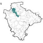
 This long, narrow area comprises the ridges of high land between the Taw Valley (to the east) and the Torridge Valley (to the west). To the north is the lower-lying Taw-Torridge Estuary, and to the south is a gradual transition to the open inland plateau of the High Taw Farmland.
 -
Constituent Landscape Character Types
Constituent LCTs: 1F: Farmed Lowland Moorland and Culm Grassland, 3A: Upper Farmed and Wooded Valley Slopes, 3H: Secluded Valleys, 5A: Inland Elevated Undulating Land. Part of NCA: 149: The Culm -
Distinctive Characteristics
- Underlying Cum Measures geology creating a series of east-west ridges, rising towards the south and supporting poorly-drained soil.
- Ridges divided by small spring-fed tributary streams, flowing into the Torridge (to the west) or the Taw (to the east).
- Extensive linear deciduous woodlands and some orchards in valleys; occasional windswept trees and hilltop clumps of beech; and blocks of coniferous plantation on higher ground.
- Farmland generally in pastoral use, with some areas of arable on better-quality land.
- Complex pattern of fields, generally with smaller, irregular fields around villages and on valley sides, and larger, more regular fields (suggesting more recent enclosure) on areas of higher land.
- Some largely intact historic field systems (e.g. around Roborough and Hiscott) adding to the time-depth of the landscape.
- Fields generally divided by hedgerows or hedgebanks in variable condition: some well-managed, others grown-out or closely flailed.
- Extensive areas of Culm grassland and semi-natural woodland habitat; farmland also supports a variety of mammals and bird species.
- Straight roads along high ground (often associated with prehistoric barrows) and a network of deep lanes and tracks on valley sides, indicating the area’s importance as a routeway for millennia.
- Many other historic landscape features including bridges, medieval castles, prehistoric earthworks and numerous manor houses.
- Parkland influence on landscape character in the north-west of the area around Tapeley Park.
- Settlement pattern of nucleated villages, generally on high ground, often clustered around a crossroads or bridge, with square church towers forming prominent landscape features.
- Scattered farmsteads, often at the end of long access tracks; many with vernacular features including whitewashed stone/ cob walls and slate or locally distinctive thatched roofs, e.g. around Tawstock.
- Long views from high ground across and into the Taw and Torridge valleys, and to Dartmoor or Exmoor, as well as views of the sea and Taw-Torridge estuary from the north of the area.
Evaluation
-
Special Qualities and Features:
- High land plays an important role as a backdrop to surrounding character areas and to the settlements of Bideford and Barnstaple.
- A sense of remoteness – despite the presence of various modern features in the landscape – with high levels of tranquillity and dark skies, particularly in the southern part of the area.
- Culm grassland sites including Pope House Moor and Beaford Moor SSSIs.
- Pockets of semi-natural ancient woodland in valleys (e.g. around Hollocombe), numerous CWSs including woodland and grassland sites; and LNR at Fremmington.
- Entire area within the North Devon Biosphere Reserve.
- Tapeley Park Registered Historic Park and Garden (grade II*) for its early 20th century formal terraces within 18th and 19th century parkland.
- Several Conservation Areas, covering historic cores of villages including Burrington, Tawstock, Beaford and Winkleigh; and numerous historic buildings including churches, farmhouses and manor houses.
- Historic features within the fabric of the landscape, such as lanes, tracks, remnant historic field patterns, stone bridges and white finger-posts.
- Several SMs, often occupying prominent positions, including prehistoric ridge-top bowl-barrows, hillforts and enclosures, the medieval Tawstock Holy Well, and two castles in Winkleigh.
- A network of lanes, tracks and public rights of way as well as extensive areas of access land such as Beaford Moor, Hollocombe Moor and Eggesford Forest.
Forces for Change and Their Landscape Implications:
-
Past and Current
- Past agricultural intensification, leading to drainage and improvement of Culm grasslands and loss of some landscape features such as hedges and hedgebanks.
- Amalgamation of farms to improve viability and construction of prominent large agricultural buildings.
- Coniferous plantations on areas of former Culm grassland (e.g. around Dolton and Huntshaw Barton).
- Loss of orchards reducing landscape diversity and habitat value.
- 20th century introduction of large-scale built features into the landscape, such as masts, pylons, quarries and, radar station, often on prominent hill-top sites.
- Industrial land uses on Winkleigh airfield, locally altering landscape character.
- Expansion of prominent ridgetop settlements (e.g. Winkleigh) and the growth of settlements up valley sides (e.g. East-the-Water).
- ‘Urban fringe’ influences on the landscape in some areas, e.g. golf clubs, fisheries, pony paddocks.
- Light spill from Barnstaple, Bideford and Great Torrington reducing the impressiveness of starlit skies in the northern part of the area.
-
Future
- Uncertainty over future levels of agricultural grants and funding, potentially reducing farm viability (in more marginal areas) and affecting management of landscape features such as hedgerows and traditional agricultural buildings.
- Loss of hedgerow trees and distinctive skyline beech clumps as a result of over-maturity and potential increases in storms and drought resulting from climate change.
- Potential future woodland planting to reduce downstream flooding and increase carbon sequestration.
- Continued settlement expansion, leading to increased visual impacts of small-scale development, particularly around prominent villages and farmsteads.
- Demand for wind turbines on high ground, potentially visible as prominent skyline features within this area and surrounding areas.
- Growing demand for other renewable energy sources including solar arrays on south-facing slopes and bio-energy crops, changing the pattern and appearance of the landscape; domestic-scale renewable energy schemes with potential cumulative impact on the built character of the area.
- Climate change, potentially affecting seasonal patterns and growing conditions, changing agricultural practices and threatening the survival of semi-natural habitats such as woodland and Culm grassland.
- New pests and diseases (e.g. Phytophthora), particularly affecting trees and woodlands.
Strategy
-
Overall Strategy:
To protect the landscape’s open skylines, and to protect and enhance its rural character. The area’s distinctive skylines, with their characteristic church towers and hill-top clumps remain free from inappropriate development. Agricultural land is well-managed, including hedgerows and patches of unimproved grassland. Historic features and surviving areas of Culm grassland are protected, along with the area’s qualities of tranquillity and dark night skies. Existing development is better-integrated into the landscape to enhance its rural character.
Guidelines:
-
Protect
- Protect open skylines – which form the backdrop to surrounding landscape character areas – from inappropriate development.
- Protect the sparse settlement pattern and characteristic building styles, ensuring that any new development is sensitively sited (and screened if appropriate) and reflects the local vernacular in terms of form and style (whilst incorporating sustainable design).
- Protect historic buildings and features and their settings, particularly those prominent in the landscape such as church towers.
- Protect intact historic field systems such as those around Roborough and Hiscott.
- Protect and manage surviving orchards.
- Protect dark night skies in the southern part of the area, resisting highways improvements and lighting schemes which would compromise them.
- Protect the high levels of tranquillity which are characteristic of this area.
-
Manage
- Manage farmland, encouraging farmers to appropriately manage ‘marginal’ land as an integral part of their farming systems.
- Manage and strengthen hedgerows, hedgebanks and associated habitats using traditional techniques.
- Manage remnant areas of unimproved grassland, through the use of appropriate levels of grazing.
- Manage isolated windswept trees and distinctive hill-top tree clumps, replacing over-mature or storm-damaged trees as necessary to retain them as features within the landscape.
- Manage plantations for sustainable timber production and wildlife interest, plus some recreational use if appropriate.
- Manage archaeological sites, including the introduction of sensitive interpretation where appropriate.
- Manage land in accordance with North Devon Biosphere Reserve guidelines.
-
Plan
- Plan to mitigate visually-intrusive sites such as Winkleigh airfield through carefully designed planting.
- Plan to link remnant areas of Culm grassland, extending them where possible to increase their biodiversity value and their resilience to climate change.
- Plan to revert plantations to grassland or broadleaved woodland at maturity and felling, possibly keeping some forest for its recreational value.
- Plan to create a green infrastructure network for larger adjoining settlements (e.g. Great Torrington, Bideford, Barnstaple), to create links with the surrounding countryside and provide a framework for potential future sustainable development.