A landscape distinguished by its landform of high, whale-backed hills, and the presence of large estates of woodland and parkland. There is a strong sense of peace and tranquillity in the woodlands and along the winding, hedge-banked lanes, with a feeling of being at the ‘heart of Devon’. This is a managed, working landscape with a strong sense of history and culture, with many historic parkland features still visible in today’s landscape. Estate villages cluster around stone bridges or crossroads, and farms nestle into folds in the hills.
-
Context
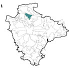
 This area, centred on the small market town of South Molton south-east of Barnstaple, comprises a well-wooded landscape with strong parkland influences. To the north and east are gradual transitions to the North Devon Downs and the South Molton Farmlands respectively. The lower land of the Taw Valley wraps around the southern and western parts of the area.
 -
Constituent Landscape Character Types
Constituent LCTs: 1D: Estate Wooded Ridges and Hilltops, 3G: River Valley Slopes and Combes, 5D: Estate Wooded Farmland Part of NCA: 149: The Culm -
Distinctive Characteristics
- Ridges of chert forming prominent hills rising above the Culm Measures mudstones with bands of sandstone; exposures of limestone, chert and sandstone visible in local quarries.
- Dramatic, distinctive east-west whale-backed ridges, surrounded by strongly undulating land.
- Landscape cut by a series of streams draining from the ridges, forming tributaries of the Taw and Bray (to the west and east respectively).
- Well-wooded character, with large bands of broadleaved beech and oak woodland (including historic wood pasture) snaking across the ridges and along stream valleys, with blocks of conifer plantation and secondary woodland on hill slopes; extensive areas of estate woodland with ancient and veteran trees.
- Traditional orchards throughout the area, with clusters around Landkey and Stowfold.
- Predominantly pastoral character with sheep and cattle grazing; hill slopes and summits providing rough grazing land, and estates including historic wood pasture, parkland and rectilinear blocks of woodland used for sport.
- Mixture of sinuous small-medium scale medieval fields and more regular larger enclosures of recent origin, bounded by mixed-species hedges with flower and fern-rich banks.
- Some high Devon hedgebanks with no topping hedgerows (particularly on hill summits); other hedgebanks topped with closely-cut mixed thorn, beech and sycamore.
- Banks on woodland edges characterised by grown-out lines of beech.
- Wealth of habitats, including heathland, bracken, semi-improved grassland, Culm grassland, rush pasture, ponds, valley mire, damp meadows, wood pasture, ancient trees and broadleaved woodlands.
- Archaeological sites in prominent locations, including Bronze Age barrows and Iron Age hillfort of Berry Castle; historic quarries, traditionally worked for roadstone, are also important landscape features.
- Several parkland estates that strongly influence landscape character, including the 18th century Castle Hill mansion (its creamy-yellow buildings standing out in the landscape) and estate features such as metal railings, fishponds, ice house and deer fencing.
- Hamlets and scattered farmsteads nestling at the base of slopes, with small villages focussed around crossroads and stream crossing points.
- Strong coherence of building styles, with a traditional vernacular of whitewash with black painted details, with some buildings of cream cob/ render as well as exposed local stone.
- Winding rural roads and tracks bounded by flower-rich Devon banks which restrict views and cross numerous streams on stone bridges; crossroads marked by distinctive white finger posts.
- Strong sense of tranquillity and history with little modern development.
Evaluation
-
Special Qualities and Features
- Hill summits of up to 190m affording spectacular panoramic views to the uplands of Exmoor (to the north), Dartmoor (to the south) and Lundy (to the north-west).
- High scenic quality, with the prominent and distinctive ridge – including Codden Hill – forming an important landscape backdrop to the surrounding area.
- Strong sense of peacefulness, with locally high levels of tranquillity; dark night skies in the southern part of the area.
- Highdown Quarry designated SSSI for its exposure of Wavellite crystals, first discovered at this site.
- Ancient woodland throughout the area; large specimen trees associated with parkland and farmland.
- Many CWSs, including heathland and unimproved grassland sites.
- Entire area within the North Devon Biosphere Reserve.
- Castle Hill Estate listed Grade I on the Register of Historic Parks and Gardens.
- SMs from many periods adding time-depth to the landscape, including prehistoric barrows and hillforts, medieval moated site and deserted village, and features associated with historic parklands.
- Several Conservation Areas, including the historic cores of Swimbridge, Littlehampton and Landkey.
- Traditional orchards, particularly around Landkey and Harford.
- The Tarka Trail recreational route passing through the north-west corner of the area.
Forces for Change and Their Landscape Implications
-
Past and Current
- 20th century and ongoing expansion of Barnstaple and the nearby villages of Swimbridge and Landkey, eroding local levels of tranquillity and changing the character of the landscape.
- Norbord factory on the western edge of South Molton forming a detracting feature in views from around Chittlehampton and the Castle Hill estate.
- Visual and noise intrusion from the A361 North Devon link road which lies in the north of the area.
- Increase in tourism and recreation, with golf courses (e.g. Portmore Golf Park) and farm diversification (e.g. campsites, equine businesses) introducing new elements into the landscape.
- Past quarrying activity (e.g. Venn Quarry) leaving visible scars in the landscape (although some former quarries are important both for nature conservation and for displaying geological exposures).
- Lines of pylons affecting the undeveloped character of the landscape.
- Neglect and limited new/ replacement planting in some areas of the parkland estate.
- Past conifer planting on areas of heathland and within semi-natural woodlands.
- Past loss of heathland (Coddon Hill) and fragmentation of remaining semi-natural sites.
- Decline in grazing levels leading to scrub encroachment on some heathland sites.
- Loss of traditional orchards and associated landscape features and biodiversity.
- Light spill from Barnstaple and south Molton reducing dark night skies in the northern part of the area.
-
Future
- Development pressure along the A361 – between Barnstaple and Landkey, and between Landkey and the South Molton Roundabout – potentially affecting views from high land.
- Continued demand for recreation/ tourist facilities, and increased traffic on rural roads.
- Change in ownership of parkland estates, bringing gradual change in character and management.
- Parkland and in-field trees increasingly susceptible to damage from storm events resulting from climate change, as well as intense summer drought conditions; growing prevalence of pests and diseases (e.g. Phytophthora), threatening survival of ancient woodland and veteran trees.
- Uncertainty over future agricultural funding and grant schemes, potentially threatening the continuation of farming on ‘marginal’ areas such as heathland on Coddon Hill, parkland management, and the care of landscape features such as hedgerows and hedgebanks.
- Potential demand for renewable energy schemes changing the character and pattern of the landscape, including wind turbines (particularly on high ridges), bio-energy crops, solar arrays (on south-facing slopes) and domestic-scale renewables which may have a cumulative impact on built form.
Strategy
-
Overall Strategy
To protect the landscape’s scenic quality and distinctive estate character. Parkland, woodland and agricultural land is well-managed to enable its continuation into the future, and to increase its resilience to climate change. The biodiversity of the area is enhanced, with heathland areas extended and appropriately grazed. Long views from high ground are protected and enhanced, and the distinctive built form (including estate villages) retains its integrity.
Guidelines
-
Protect
- Protect the historic character of the landscape, avoiding intrusive or insensitive developments.
- Protect long views from high ground and designed estates.
- Protect and manage surviving traditional orchards.
- Protect historic landscape features such as estate railings, bridges and white finger posts, restoring or repairing as necessary.
- Protect and appropriately manage the nationally-important features relating to the Castle Hill Estate (including parklands, fishpond, park pale, ice house and deer fencing).
- Protect locally-distinctive vernacular building techniques, and ensure any new development respects traditional settlement forms (avoiding linear spread) and building styles (whilst incorporating sustainable design).
- Protect rural lanes and tracks and their associated hedges and flower-rich hedge-banks, resisting unsympathetic highways measures and intrusive signage.
- Protect and appropriately manage archaeological sites, introducing sensitive interpretation where appropriate.
- Protect important geological exposures revealed through past quarrying activity.
-
Manage
- Manage parkland, resisting the conversion of pasture to arable land and managing park grasslands extensively to protect tree root zones from damage through compaction, nutrient inputs and stock damage.
- Manage remaining ancient and veteran parkland trees, including through traditional pollarding where appropriate.
- Manage woodland (including use of traditional techniques such as coppicing) and investigate opportunities for the use of wood-fuel; control access by livestock and deer, promoting natural regeneration and using extensive grazing to enhance species diversity of woodland ground flora.
- Manage and expand semi-natural heathland habitats, including through the use of appropriate grazing and burning as necessary.
- Manage agricultural land, increasing its biodiversity where possible, and looking after hedgerows and hedgebanks.
-
Plan
- Plan for long-term renewal of parkland, including the planting of the next generation of veteran trees (choosing a diversity of species to improve resistance to pests and climate change).
- Plan for re-creation of orchards, possibly as community schemes.
- Plan for continued development of larger settlements in the area, integrating new development into the landscape and providing green infrastructure links into the countryside.
- Plan for the expansion of lowland heathland around Codden Hill, with remnant sites re-linked to form an intact habitat network.
- Plan for potential habitat re-creation in disused quarry sites, whilst protecting important geological outcrops.
- Plan to reduce light spill from nearby settlements.