This area is made up of a variety of landscape types which together give rise to a distinctive coastal landscape, exposed to salt laden winds and comprising open plateau, dramatic cliff, secretive undercliff, steep wooded combe valleys and river estuary. Here the senses are stimulated by stunning scenery and dramatic landform, lofty remoteness on the plateau tops and contrasting dark secretive inaccessible undercliff and intimate picturesque settled combes. Both the plateau top and estuaries have a strong horizontal emphasis and a sense of space and air while from the cliff tops there are distinctive views out to sea and also along the cliffs. In parts the distinctive coastal cliffs are of chalk and limestone and are unique in a Devon context while to the west the cliffs are red sandstone.
-
Context
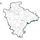
This area comprises a coastal landscape of open plateau, approximately 2-4km wide, which
 extends between Exmouth in the west and the county boundary with Dorset in the east and which drops, as cliffs, dramatically to the sea to the south. To the north the plateau quickly gives way to a landscape of ridges and valleys, including the East Devon Central Ridge and the Axe Valley.
 -
Constituent Landscape Character Types
Constituent LCTs: 1B: Open Coastal Plateau, 1C: Pebble Bed Heaths, 3A: Upper Farmed and Wooded Valley Slopes, 4B: Marine Levels, 4D: Coastal Slopes and Combes, 4H: Cliffs Part of NCA: 147: Blackdowns -
Distinctive Characteristics
- Geology of chalk with limestone, mudstone, siltstone and sandstone, in places is overlain by superficial deposits of clay with flints.
- Coastal cliffs of chalk changing to red sandstone in the west with pebble and sandy beaches.
- The landform varies from steep cliff to horizontal estuary and from open exposed coastal plateau to incised steep combe valleys which penetrate, curve and branch inland.
- Woodland and vegetation is restricted to more sheltered locations of the combe valleys and undercliff; while trees on the open plateau top comprise distinctive shelterbelts of Monterey pine and larch or occasional windblown knarled hedgerow trees.
- Mainly arable land use on the plateau top with medium-sized regular fields defined by low hedgebanks (reflecting late enclosure of waste), with small scale fields on old cliff landslips e.g. Branscombe, Beer.
- Steep combe valley sides mainly pastoral with small irregular fields.
- Semi-natural habitats that include the undercliff, where landslips have occurred and scrub and woodland vegetation has developed, chalk grasslands, saltmarsh, mudflats and old ash pollards important for lichen flora.
- Historic settlements in the combes and larger settlements on the estuaries ( Beer, Sidmouth, Budleigh Salterton and Exmouth).
- Area of high tranquillity away from larger settlements and A3052 coastal road, particularly in the sheltered combes.
- Exceptional views out to sea and along the coast.
Evaluation
-
Special Qualities and Features:
- Most of area designated as part of the East Devon AONB, nationally valued for its scenic qualities.
- Area between the cliff tops and Mean Low Water Mark forms part of the Dorset and East Devon Coast WHS, of outstanding world value for its geological and geomorphological formations (particularly fossils).
- The chalk and limestone cliffs unique in a Devon context and the most westerly chalk cliffs in England.
- Rare chalk grassland along the coast which is designated SSSIs and CWS.
- Shingle beach between Beer Head and Sidmouth is one of three UK sites for the rare scaley cricket.
- Undercliffs valued for nature conservation and geological formations – Sidmouth to Beer Coast SSSI and SAC and Axmouth to Lyme Regis Undercliffs SSSI, SAC and NNR.
- Estuary habitats valued for their saltmarshes and mudflats (i.e. Otter Estuary SSSI and LNR and Otter Meadows CWS).
- Historic Park and Garden at Rousdon.
- High value for recreation, including part of the South West Coastal Path long distance route.
- Many cultural associations with writers and artists who have been inspired by the dramatic coastal scenery including Lionel Aggett, John Fowles and Carolyn Vernon.
Forces for Change and Their Landscape Implications:
-
Past and Current
- Busy coastal road (A3052) popular with tourists in the summer months, which impacts on tranquillity of the open plateau.
- Loss of hedgerows from the open coastal plateau.
- Highly visible car park and holiday park development adjacent to Beer Head.
- Erosion of country lanes due to high volumes of traffic.
- Development that locally extends on to steeper slopes making it more visible from surrounding areas.
- Loss of traditional settlement form and character (due to new development including light industrial units as well as residential) and introduction of uncharacteristic vertical elements into the cliff and estuary landscapes.
- Development of masts on exposed headlands and open tops.
- Blocking of the Otter and Axe mouths by the growth of shingle bars which have checked the flow of the rivers and caused silting.
- Past establishment of conifer plantations.
- Rapid coastal erosion from Sidmouth to Branscombe.
-
Future
- Sea level rise and further coastal erosion.
- Development of coastal sea defences to protect coastal settlements threatening the geodiversity of the coastal cliffs by preventing the natural process of coastal erosion.
- Further growth in popularity of the area for recreation and tourism, resulting in pressure for new recreational development including holiday parks, infrastructure and signage particularly in exposed locations, in turn affecting openness and tranquillity.
- Future growth of coastal settlement, further intruding into the estuary landscapes.
- Increasing demand for tidal energy from estuaries in response to government targets for climate change mitigation.
- Pressure for offshore wind energy development in response to climate change.
- Uncertainty over future agri-environment scheme funding putting conservation of wildlife habitats at risk.
Strategy
-
Overall Strategy
To protect the area’s outstanding coastal scenery including the openness and horizontal emphasis of the coastal plateau and estuary landscapes; the distinctive wooded and pastoral combes and their wildlife interest; and the distinctive character of small settlements. Local communities are involved in planning for future landscape change as a result of sea level rise and changes in coastal erosion, ensuring balance between sea defence and natural processes. Both existing and new development is integrated into its landscape setting and the area’s popularity as a tourist destination is managed to provide further sustainable recreational opportunities whilst ensuring landscape character is managed and strengthened.
Guidelines
-
Protect
- Protect the open and largely undeveloped character of the cliffs, avoiding the siting of new development and vertical structures on prominent skylines immediately above or along the coastline which is otherwise pristine.
- Protect the character of the landscape’s expansive sea views.
- Protect the landscape’s wild and highly tranquil qualities by promoting sustainable tourism and recreation which benefits the local economy throughout the year.
- Protect and sensitively interpret the coastline’s outstanding geological and geomorphic features and raise awareness of the dynamic nature of the coast.
- Protect the historic character of the combe villages and their settings, ensuring limited new development or property extensions that incorporate local buildings styles (whilst seeking to incorporate sustainable and low carbon construction and design).
- Protect the villages’ contained form, resisting linear spread or coalescence.
- Protect the landscape’s network of winding rural lanes, resisting unsympathetic highway improvements (e.g. hedgerow/woodland cutting) or signage; promote sustainable transport options to reduce traffic levels during busy holiday periods.
- Protect open emptiness of the coastal plateau and estuaries and the strong horizontal emphasis of these areas, avoiding the location of new development and vertical structures on prominent skylines.
-
Manage
- Manage the landscape’s valued ancient oak-ash-maple woodlands around settlements and in the sheltered combes, controlling alien species. New planting should consider species of greater resilience to climate change. Traditional woodland management (including coppicing) should be revived, with wood promoted as a sustainable energy source for local communities.
- Manage and protect the landscapes network of hedgerows and characteristic dwarf or windswept hedgerow trees, replanting ageing or diseased specimens to ensure the future survival of these characteristic features.
- Manage nationally important coastal habitats, including coastal heath and maritime grassland, by supporting a continuation of extensive grazing at appropriate levels.
- Manage and extend areas of wet grazing marsh and meadows in the valleys through appropriate grazing and traditional land management regimes both to enhance their wildlife value and function as flood prevention.
- Resist agricultural improvements or conversion to arable or horticulture.
- Manage farmland ash trees – promote traditional tree management practices such as pollarding, protect from overgrazing and ploughing, and select new trees to develop as replacements or plant as necessary.
-
Plan
- Plan for the impacts of climate change on the coastline, allowing natural processes to take place whilst considering how habitats and the South West Coast Path can adapt or relocate to take account of coastal squeeze.
- Plan to integrate existing and any new development such as parking, holiday accommodation and housing into the landscape effectively through careful attention to siting and, where appropriate to the relatively open landscape context.