The maps on our Environment viewer hold information on sites that are important for their geology. County Geological Sites are clearly mapped under the Environment viewer, Ecology and Geology tab, Wildlife site data, non-statutory sites for County Geological Sites (by point) and County Geological Sites (by region).
There are also other sites that are important for their geology, that may not be designated as County Geological Sites. For example, Sites of Special Scientific Interest (SSSIs), are designated for wildlife and or geological interest and are of national importance. In the Environment Viewer, go to Ecology and Geology tab, wildlife site data, Statutory Sites, and Sites of Scientific Interest. Then click within the boundary of a SSSI on the map, to find out the site name. For example, in central Exeter (click on the screenshot below to expand) the tiny green line in the top left section of the map has been selected (turns blue when selected) is Bonhay Road Cutting SSSI. You can then find further information on these sites if you search the name on the Natural England webpages.
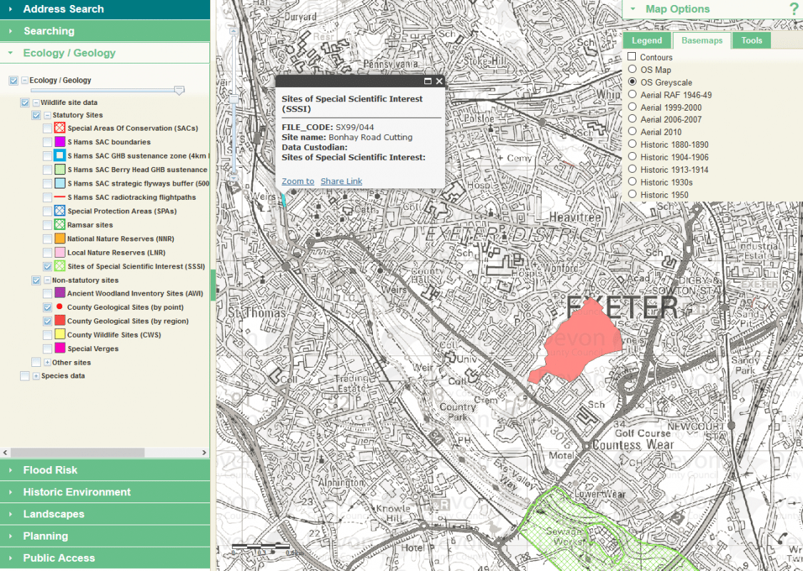
To make the sites stand out more clearly from the background, we recommend changing the map options (top right menu), basemaps tab, to OS Greyscale.